$78.34
Add to Cart
VEU452S BlueChart G2 HD Vision MARINE GPS MAP micro SD/SD ADRIATIC SEA NORTH CO
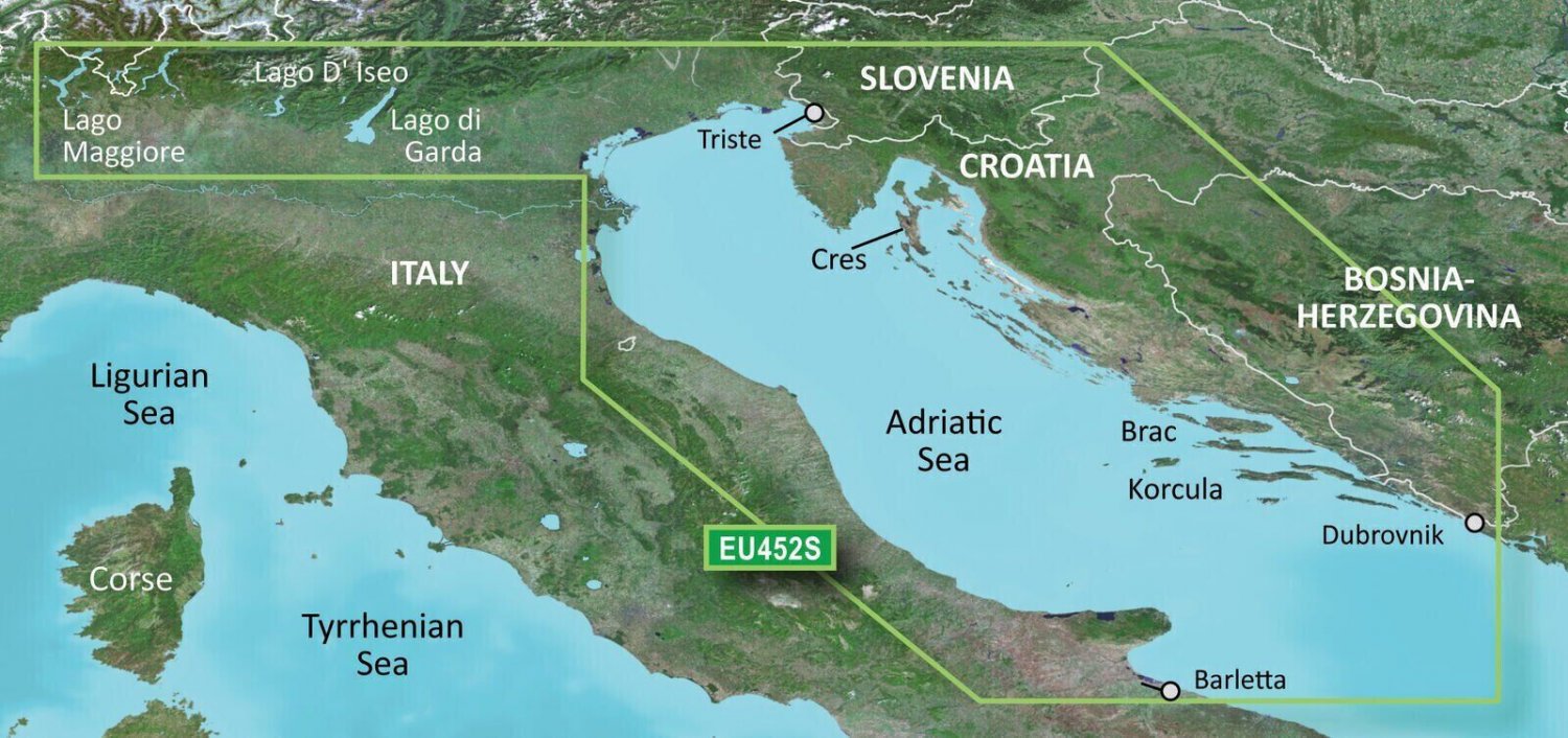


VEU452S - ADRIATIC SEA NORTH CO BlueChart® g3 Vision® HD - VEU452S - Adriatic Sea, North Coast - microSD™/SD™ Coverage: Adriatic Sea from Barletta north to Monfalcone, Italy southeast to Dubrovnik, Croatia. Includes detailed coverage of Lago Maggiore, Lago d'Iseo, and Lago d'Garda in Italy. Premier Coastal ChartsIndustry-leading coverage, clarity and detail with updated coastal charts that feature integrated Garmin and Navionics® contentAuto Guidance¹ technology quickly calculates a suggested route by using your desired depth and overhead clearanceIncludes Depth Range Shading for up to 10 depth ranges, enabling you to view your target depth at a glanceUp to 1’ contours provide a more accurate depiction of the bottom structure for improved fishing chartsTo give a clear picture of shallow waters to avoid, the Shallow Water Shading allows for shading at a user-defined depth Experience unparalleled coverage and brilliant detail when you’re on the water. BlueChart g3 Vision coastal charts provide industry-leading coverage, clarity and detail with integrated Garmin and Navionics content. This version is not locked so it can be used in mulitple units that are compatible, it only works in a compatible gps. Features Includes realistic navigation features showing everything from shaded depth contours and coastlines to spot soundings, navaids, port plans, wrecks, obstructions, intertidal zones, restricted areas, IALA symbols and more.Features smooth displays, including seamless transitions between zoom levels and more continuity across chart boundaries.Allows users to choose between standard 2-D direct overhead or 3-D "over the bow" map perspective to make chart reading and orientation easier.Provides Safety Shading (in compatible units), allowing mariners to enable contour shading for all depth contours shallower than user-defined safe depths.Provides Fishing Charts (in compatible units), allowing mariners to scope out bottom contours and depth soundings with less visual clutter on the display. We will promptly answer any questions you might have. Tracked delivery by USPS First Class. OpenStreetMap® is open data, licensed under the Open Data Commons Open Database License (ODbL) by the OpenStreetMap Foundation (OSMF) "Garmin" is a registered trademark Garmin Ltd This product is not affiliated with Garmin. Photos are for reference only

