$51.69
Add to Cart
LCA100F Canada LakeVu HD Ultra Lake GPS Maps for compatible ChartPlotters
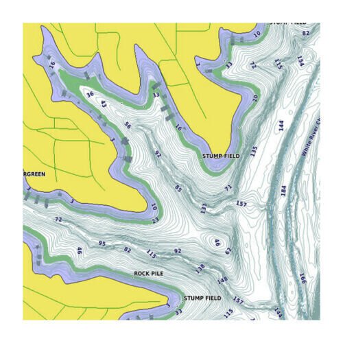


Canada LakeVu HD Ultra Lake Maps, 010-C1114-00(LCA100F ). The sale includes a pre-loaded microSD card and an optional full size SD adapter is available upon request. The ultimate freshwater fishing map, LakeVü HD Ultra includes the most detailed inland waters maps ever. Features: Contains more than 6,000 freshwater Canadian lakes; 1,000 in Alberta, British Columbia, Nova Scotia, Ontario, Quebec, Saskatchewan and Yukon provinces as well as the Great Lakes and Trent Severn Waterway have 1 foot high definition contours shore-to-shoreAdds visual depth to 2-D maps, making it easier to interpret humps and valleys on HD lakes (High Resolution Relief Shading)Simplifies navigation by suggesting the best paths on HD lakes (Auto Guidance technology)Pinpoints the best fishing spots with high-resolution Depth Range Shading, which allows you to view your target depth at a glanceDiscover the LakeVu HD Ultra AdvantageGain the upper hand when it comes to navigating and fishing your favorite lakes, rivers and reservoirs. LakeVu HD Ultra maps bring the richest level of detail possible to your chartplotter. Each U.S. map region includes a growing number of HD lakes with 1' bottom contours across all depths.LakeVu HD Ultra allows you to use Auto Guidance to create a safe course to anywhere on the lake, avoiding shallow water and other obstructions along your way. View high-resolution satellite imagery for a top-down view of your surroundings, or use 3-D MarinerEye and FishEye perspective views to visualize your position above or below the waterline. Or use Depth Range Shading to stay within your fishing sweet spot by highlighting a particular depth. You can even fine-tune the LakeVü HD Ultra maps by adjusting them to account for current water levels.COVERAGE: Features detailed coverage of more than 6,000 freshwater Canadian lakes; more than 1,000 lakes in Alberta, British Columbia, Nova Scotia, Ontario, Quebec, Saskatchewan and Yukon provinces as well as the Great Lakes and Trent Severn Waterway are high def with 1 foot contours shore-to-shore. Note: The advance features may not be available for every lakes. To check a specific lake coverage, please check: lakes.garmin.com in your web browser. Compatible Devices:Alpha 200i echoMAP™ 43dv / 44dv / 50dv / 50s / 53dv / 54dv / 70dv / 70s / 73dv / 73sv / 74dv / 74sv / 93sv / 94svechoMAP™ CHIRP 42cv / 42dv / 43cv / 43dv / 44cv / 44dv / 45cv / 45dv / 52cv / 52dv / 53cv / 53dv / 54cv / 54dv / 55cv / 55dv / 72cv / 72dv / 72sv / 73cv / 73dv / 73sv / 74cv / / 74sv / 75cv / 75dv / 75sv / 92sv / 93sv / 94sv / 95svNOT working in echoMAP plus & UHD series.GPSMAP 1020xs / 1040xs / 527xs / 547 / 547xs / 721xs / 722xs / / 741xs / 7408 / 7410 / 7412 / 7416 / 7607 / 7608 / 7610 / 7612 / 7616 / 8208 / 8212 / 8215 / 840xs / 8500 / 8530 / 8617 / 8622 / 8624 MFD / 922 / 942SHIPPING:by USPS First Class Package with tracking info (only in domestic shipping), We ship out the item in the next business day after receive the payment. The default shipping option is a 3/4-day standard shipping to any US territories. Buy with confidence from a eCRATER verified seller - you are protected. SATISFACTION GUARANTEED OR YOUR MONEY BACK!If you are not satisfied with your purchase for any reason you may return it to us within 30 days for full refund. OpenStreetMap® is open data, licensed under the Open Data Commons Open Database License (ODbL) by the OpenStreetMap Foundation (OSMF) "Garmin" is a registered trademark Garmin Ltd Photos are for reference only

